- Location
- New Jersey/Pennsylvania
- Current protection
- Delaware Water Gap National Recreation Area, Middle Delaware National Scenic and Recreational River, Worthington State Forest (NJ)
- Status
- Active citizen campaign; no bill
- In the book
- Not featured in Undiscovered America
Why should it be a National Park?
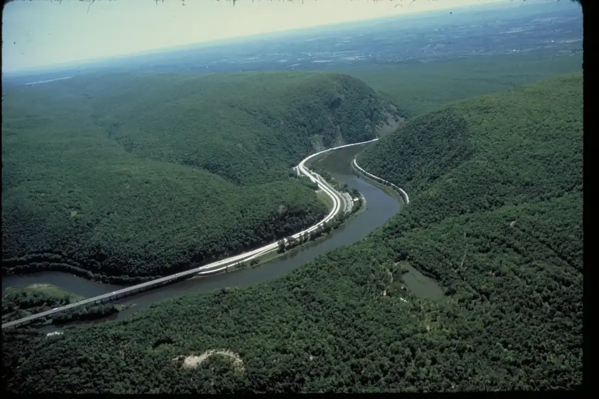
The Delaware River cuts an S-shaped notch through Kittatinny Ridge, and on either side of that notch lies seventy thousand acres of public land within seventy-five miles of both New York City and Philadelphia. Four million people visit every year. It is one of the most heavily used landscapes in the National Park System, and it exists because of a dam that was never built.
In August 1955, Hurricane Diane flooded the valley and killed seventy-five people, thirty-seven of them mostly children at a camp on Brodhead Creek. Congress authorized the Tocks Island Dam in 1962, and the Army Corps of Engineers began buying land for a reservoir. More than fifteen thousand people were displaced, many by eminent domain, and whole villages in the Walpack Valley were emptied. Then the dam fell apart politically. The Delaware River Basin Commission voted it down in 1975, Congress deauthorized it in 1992, and the government was left holding seventy thousand acres of land it had taken for a lake that does not exist.
What survives instead is a free-flowing river, one of the last major ones in the East, with Raymondskill Falls dropping in tiers on the Pennsylvania side and Dingmans Falls a few miles north. Sunfish Pond, a glacial lake on the ridge, was saved from becoming a pumped-storage reservoir in part by a 1967 protest hike led by Supreme Court Justice William O. Douglas. The Minisink was Munsee Lenape homeland for thousands of years, and the archeological site there is a National Historic Landmark.
Since 2022 a coalition led by a retired superintendent of the recreation area has pushed to redesignate it a National Park and preserve, arguing that recreation area was always the wrong name for a place whose reservoir never came. The opposition is rooted in something specific: the memory of the taking. People here watched the government seize fifteen thousand neighbors' homes for a project it then abandoned, and a proposal to change the sign at the entrance sounds, to them, like the opening move of something larger. A congressman blocked funding for the redesignation in 2024. No bill has been introduced. The dam's opponents were proved right about the river, and their descendants are now the ones most suspicious of the park.
The history of National Park Campaigns
The Delaware Water Gap National Recreation Area, roughly 70,000 acres, exists because of the aborted Tocks Island Dam: land bought for a reservoir became a recreation area in 1965 after the dam was killed. Since 2021–22 the Delaware River National Park and Lenape Preserve Alliance, led by retired superintendent John Donahue with Sierra Club chapters, has pushed to redesignate it a National Park and preserve. Organized opposition and a 2024 congressional funding block have stalled it; no bill has been introduced.
- Distinct National Park attempts
- 1 organized campaign (2021–present; no bill)
- Other designation attempts
- 2 (recreation area 1965; scenic and recreational river 1978)
Sources
- NPS, 'Forming and Managing the Park,' Delaware Water Gap NRA
- NPS CRM Journal vol. 25 no. 3 (2002) on Tocks Island
- Delaware River National Park and Lenape Preserve Alliance materials (ourpark.org)
- WVIA and Delaware Currents coverage, 2022–2024
- 1930s
Army Corps of Engineers first proposes a dam on the middle Delaware.
- August 1955
Hurricane Diane floods the valley; 75 deaths, including 37 at a Brodhead Creek camp.
- 1962
Congress authorizes the Tocks Island Dam; the Corps begins acquiring roughly 72,000 acres, displacing more than 15,000 people.
- September 1, 1965
Delaware Water Gap National Recreation Area authorized (P.L. 89-158) to manage the lands around the planned reservoir.
- 1966–1967
The Lenni Lenape League forms over Sunfish Pond; Justice William O. Douglas leads a protest hike in 1967.
- 1975
The Delaware River Basin Commission votes 3-1 against the dam.
- 1978
Middle Delaware National Scenic and Recreational River designated, blocking future dams.
- 1992
Tocks Island Dam deauthorized.
- 1993
Minisink Archeological Site designated a National Historic Landmark.
- 2021–2022
Delaware River National Park and Lenape Preserve Alliance launches the redesignation campaign; a 'No National Park' opposition group forms in Layton, New Jersey.
- September 2023
Revised proposal: roughly 9,760 acres as National Park, more than 56,000 acres as a Lenape preserve where hunting continues, with a prohibition on entrance fees.
- July 2024
The House passes a measure blocking National Park Service funds for the redesignation.