- Location
- Alaska
- Current protection
- Misty Fiords National Monument, Misty Fiords Wilderness, Tongass National Forest
- Status
- No park campaign on record
- In the book
- Not featured in Undiscovered America
Why should it be a National Park?
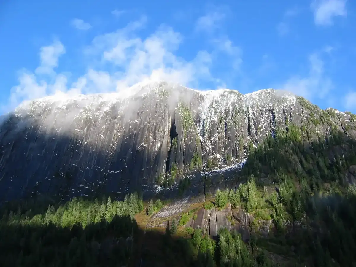
Behm Canal is a hundred and seventeen miles of natural fjord, and the granite walls above it rise three thousand feet straight out of saltwater. Misty Fjords covers more than two and a quarter million acres of this country at the southern end of the Alaska panhandle, which makes it larger than Yellowstone, and almost nobody sees it from the ground. There are no roads. Access is by floatplane or boat out of Ketchikan, forty miles west.
The rain is the defining fact. More than a hundred and fifty inches fall in a year, and the result is a landscape where waterfalls pour off cliff tops directly into the sea and the fog sits in the fjords for days. The temperate rainforest below is Sitka spruce and western hemlock, some of it never logged. Brown and black bears both live here. All five species of Pacific salmon spawn in the streams. Mountain goats work the cliffs above the water.
This is Tlingit country, and has been for thousands of years. New Eddystone Rock, a volcanic pillar two hundred and thirty feet tall standing alone in the middle of Behm Canal, is the landmark every boat passes and every photograph includes. George Vancouver named it in 1793 after a lighthouse in the English Channel.
Misty Fjords has never been proposed as a National Park, and its history is worth understanding for a different reason. Carter proclaimed it a national monument in 1978, and ANILCA confirmed it in 1980 while deliberately carving out a hundred and fifty thousand acres for Quartz Hill, a molybdenum deposit thought to hold something like a tenth of the free world's supply. A mining company spent years and millions pursuing it before economics killed the project. The deposit is still there. The carve-out is still there. A landscape that would be a flagship National Park in any other country is protected by a designation that was written around a mine.
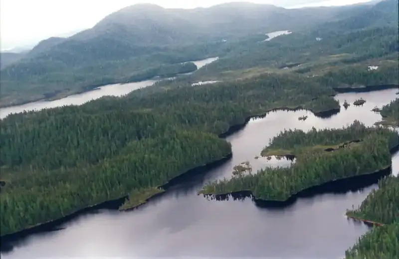
Almost nobody arrives by road, because there is none. Visitors come out of Ketchikan by floatplane or on a day boat up Behm Canal, and the monument's two and a quarter million acres absorb them without a trace. Most of it is designated wilderness, which in practice means a shoreline with a few Forest Service cabins on it and a great deal of country behind that nobody walks.
The water does the work. Rivers here run salmon in numbers that support the bears, the eagles, and a commercial fishery, and the fjord walls are scored by glaciers that left the granite polished and vertical. Sea lions haul out at the mouth of the canal, whales work the passage, and the whole system is fed by rain on a scale that would be a disaster anywhere else.
No park bill has been filed here for a structural reason rather than a scenic one. Alaska's designations were settled in a single enormous bargain in 1980, and nothing since has reopened it. What ANILCA wrote into this monument, the mining access and the Tongass management, is the list of terms any park bill would have to address. The landscape is already managed as wilderness and already meets the standard; what it lacks is a sponsor willing to reopen an Alaska lands question.
The history of National Park Campaigns
Misty Fjords, 2,294,343 acres of fjord and rainforest in the Tongass National Forest, has never had a National Park proposal; its designation history is a monument-and-mine story. President Carter proclaimed it a national monument December 1, 1978, and ANILCA (1980) confirmed it while designating all but 151,832 acres as wilderness, deliberately excluding the Quartz Hill molybdenum deposit. The mine was pursued through the 1980s and abandoned on economics.
- Distinct National Park attempts
- 0
- Other designation attempts
- 2 (national monument 1978; wilderness 1980)
Sources
- Alaska National Interest Lands Conservation Act (P.L. 96-487)
- U.S. Forest Service, Quartz Hill Final Environmental Impact Statement (USDA-FS-R10-MB-41a, 1988)
- Presidential Proclamation 4623 (December 1, 1978)
- Tongass National Forest management records, Ketchikan-Misty Fiords Ranger District
- December 1, 1978
President Carter proclaims Misty Fiords National Monument, roughly 2.28 million acres, under the Antiquities Act.
- January 4, 1979
Administrative RARE II wilderness proposal for the area.
- 1980
The Alaska National Interest Lands Conservation Act (P.L. 96-487) confirms the monument by statute and designates all but 151,832 acres as wilderness, the carve-out covering the Quartz Hill molybdenum deposit.
- 1980s
U.S. Borax pursues the Quartz Hill mine; the Forest Service issues a final environmental impact statement in 1988. The project is abandoned on economics late in the decade.
- Present
Managed by the Forest Service as monument and wilderness; no National Park proposal on record.