- Location
- Utah
- Current protection
- Cedar Breaks National Monument, Ashdown Gorge Wilderness, Dixie National Forest
- Status
- No active campaign
- In the book
- Not featured in Undiscovered America
Why should it be a National Park?
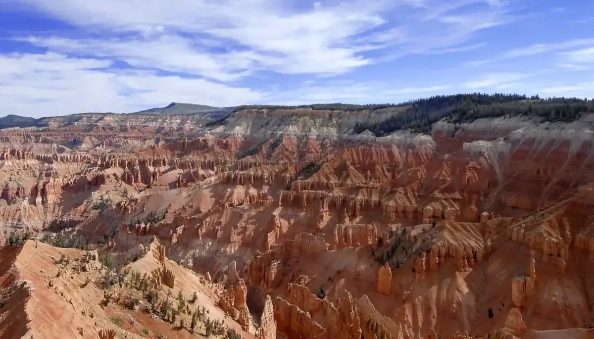
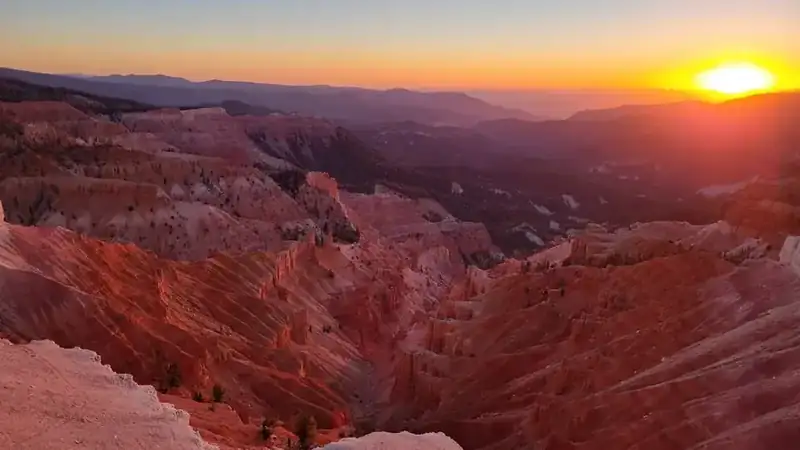
Cedar Breaks is a three-mile amphitheater eroded more than two thousand feet into the western edge of the Markagunt Plateau, and its rim sits above ten thousand feet. The rock is the same Claron Formation that makes Bryce Canyon, stained by iron and manganese into oranges, purples, and whites, and the altitude means the view comes with bristlecone pines and, for much of the year, snow.
That altitude is what keeps the crowds away. The road closes in winter. The visitor season is short. Bryce Canyon, ninety minutes east and two thousand feet lower, draws several times the visitation for a landscape of the same geology and arguably less vertical drama.
The Paiute knew the amphitheater as the circle of painted cliffs. Mormon settlers named it for the junipers they miscalled cedars and the badlands they called breaks, producing a name that is wrong twice over. The Civilian Conservation Corps built the visitor center and rim trails in the 1930s.
A movement to hand Cedar Breaks to the new Park Service began in 1919, and the compromise, as it so often was, came in 1933 as a national monument carved out of the Dixie National Forest. In 2006 Iron County officials floated expanding it to take in the Ashdown Gorge Wilderness and Flanigan Arch and renaming the whole thing a National Park. Nothing came of it. Utah already has five National Parks, and Cedar Breaks remains the sixth in everything but name.
Age is the other thing the altitude buys. Bristlecone pines grow along the rim, some of them well over a thousand years old, wind-carved into shapes that look deliberate. Below them, for a few weeks in July and August, the subalpine meadows run to wildflowers thick enough that the monument built a festival around them. Almost nobody sees both, because the two things happen in the same short window when the road is finally clear.
At night the case gets easier. The monument sits far from any city, high and dry, and the sky over the amphitheater is among the darkest readings anyone takes in the lower forty-eight. It is certified as an international dark sky park, and the rangers run star parties on the rim at ten thousand feet, which is a different experience from the same program run at sea level.
The hard fact for a park proposal is size. Cedar Breaks is roughly six thousand acres, a fraction of the smallest National Parks, and it is surrounded on all sides by the Dixie National Forest. Any serious proposal has to be a proposal for the whole plateau edge, Ashdown Gorge and Flanigan Arch included, which means taking land from another federal agency with its own constituency. That, and not the quality of the landscape, is what keeps the conversation at the county level.
The history of National Park Campaigns
A three-mile amphitheater eroded more than 2,000 feet, its rim above 10,000 feet, Cedar Breaks was proclaimed a national monument in 1933, excised from the Dixie National Forest. A movement to transfer it to the NPS began in 1919; in 2006 Iron County officials considered expanding and renaming it Cedar Breaks National Park. Dormant since.
- Distinct National Park attempts
- 2 (1919; 2006)
- Other designation attempts
- 2 (monument 1933; wilderness recommendations 1971/1976)
Sources
- Hal Rothman, 'Shaping the Nature of a Controversy: The Park Service, the Forest Service, and the Cedar Breaks Proposal,' Utah Historical Quarterly
- Utah History Encyclopedia, 'Cedar Breaks National Monument'
- Presidential Proclamation 2054 (August 22, 1933)
- 1919
Movement begins to transfer the area to the new National Park Service.
- August 22, 1933
Cedar Breaks National Monument proclaimed (Proclamation 2054), excised from the Dixie National Forest.
- 1930s
Civilian Conservation Corps builds the visitor center and rim facilities.
- 1971 and 1976
Wilderness recommendations covering 4,830 acres.
- 2006
Iron County officials propose expanding the monument to include Ashdown Gorge Wilderness, Flanigan Arch, and private inholdings, and renaming it Cedar Breaks National Park. No bill followed.